| dc.contributor.author | Chacon-Barrantes, Silvia | |
| dc.contributor.author | Arcos, Nicolas | |
| dc.contributor.author | VARNER, JESSE | |
| dc.contributor.author | López, Alberto M. | |
| dc.date.accessioned | 2020-05-27T23:19:23Z | |
| dc.date.available | 2020-05-27T23:19:23Z | |
| dc.date.issued | 2018 | |
| dc.identifier.other | Abstract NH41C-1005 | |
| dc.identifier.uri | http://hdl.handle.net/11056/17449 | |
| dc.description | resumen disponibie en https://abstractsearch.agu.org/meetings/2018/FM/NH41C-1005.html | es_ES |
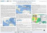
| dc.description.abstract | Since 2011, UNESCO - Intergovernmental Oceanographic Commission (IOC) Experts Meetings and CaribeWave exercises have resulted in a variety of tsunami models of credible scenarios that would impact the Caribbean and adjacent regions. However, results generated from such scenarios were not readily available to potential users such as emergency management officials and decision makers. During the 12th Session of the Tsunami and Other Coastal Hazards Warning System for the Caribbean and Adjacent Regions (ICG/CARIBE-EWS) in May 2017, a formal recommendation was adopted for the working group on Hazard Assessment to compile the aforementioned tsunami scenarios with their associated tsunami energy plots in addition to other valuable tsunami data products from NOAAs National Centers for Environmental Information (NCEI), and World Data Service (WDS) for Geophysics. In response to this recommendation, the Caribbean and Adjacent Regions Tsunami Sources and Models (CATSAM) map viewer was developed by NCEI/WDS and the Universidad Nacional, Costa Rica. CATSAM is intended to be a tool for modelers and hazard assessment professionals, based on the UNESCO/IOC led efforts on defining tsunami potential within the region. It provides the seismic parameters to reproduce the scenarios, as well as how they overlap with the Global Historical Tsunami Database developed and maintained by NCEI/WDS. CATSAM currently has 41 defined rupture geometries and 13 energy plots divided into 15 sub-regions. The map viewer was implemented using the ArcGIS API for JavaScript, built upon geospatial services published with ArcGIS Enterprise. While CATSAM is an initiative of the ICG/CARIBE-EWS, upcoming IOC/UNESCO Experts Meetings on tsunami sources for Pacific subregions could provide an augmented collection of tsunami scenarios for other tsunami prone areas of the world. | es_ES |
| dc.description.abstract | Desde 2011, la UNESCO - Reuniones de expertos de la Comisión Oceanográfica Intergubernamental (COI) y los ejercicios de CaribeWave han dado lugar a una variedad de modelos de tsunami de escenarios creíbles que afectarían el Caribe y las regiones adyacentes. Sin embargo, los resultados generados a partir de tales escenarios no estaban fácilmente disponibles para los usuarios potenciales, como los funcionarios de gestión de emergencias y los responsables de la toma de decisiones. Durante la duodécima sesión del Sistema de Advertencia de Tsunamis y Otros Peligros Costeros para el Caribe y las Regiones Adyacentes (ICG / CARIBE-EWS) en mayo de 2017, se adoptó una recomendación formal para el grupo de trabajo sobre Evaluación de Peligros para compilar los escenarios de tsunami antes mencionados con sus parcelas de energía de tsunami asociadas, además de otros valiosos productos de datos de tsunami de los Centros Nacionales de Información Ambiental (NCEI) de NOAAs y el Servicio Mundial de Datos (WDS) para Geofísica. En respuesta a esta recomendación, NCEI / WDS y la Universidad Nacional de Costa Rica desarrollaron el visor de mapas de fuentes y modelos de tsunamis del Caribe y regiones adyacentes (CATSAM). El objetivo de CATSAM es ser una herramienta para modeladores y profesionales de evaluación de riesgos, basado en los esfuerzos liderados por la UNESCO / COI para definir el potencial de tsunami en la región. Proporciona los parámetros sísmicos para reproducir los escenarios, así como también cómo se superponen con la Base de datos global histórica de tsunamis desarrollada y mantenida por NCEI / WDS. Actualmente, CATSAM tiene 41 geometrías de ruptura definidas y 13 diagramas de energía divididos en 15 subregiones. El visor de mapas se implementó utilizando la API de ArcGIS para JavaScript, construida sobre servicios geoespaciales publicados con ArcGIS Enterprise. Si bien CATSAM es una iniciativa del ICG / CARIBE-EWS, las próximas reuniones de expertos de la COI / UNESCO sobre fuentes de tsunami para las subregiones del Pacífico podrían proporcionar una colección aumentada de escenarios de tsunami para otras áreas del mundo propensas a tsunamis, | es_ES |
| dc.description.sponsorship | Universidad Nacional, Costa Rica | es_ES |
| dc.language.iso | eng | es_ES |
| dc.rights | Acceso abierto | es_ES |
| dc.source | Chacon-Barrantes, Silvia and Varner, Jesse and Lopez, Alberto}, title = {Caribbean and Adjacent Regions Tsunami Sources and Models (CATSAM) Map Viewer}, journal = {Earth and Space Science Open Archive}, pages = {1}, year = {2019}, DOI = {10.1002/essoar.10500346.1}, url = {https://www.essoar.org/doi/abs/10.1002/essoar.10500346.1}, | es_ES |
| dc.subject | TSUNAMI | es_ES |
| dc.subject | OCEONOGRAFÍA | es_ES |
| dc.subject | GEOFÍSICA | es_ES |
| dc.title | Caribbean and Adjacent Regions Tsunami Sources and Models (CATSAM) Map Viewer | es_ES |
| dc.type | http://purl.org/coar/resource_type/c_6670 | es_ES |
| dc.description.procedence | SINAMOT | es_ES |